Login
Support Sailonline
If you haven't already - join the SAILONLINE YACHT CLUB!
Please also consider making a donation - all amounts are greatly appreciated!
|
Posted by Tempest 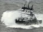 |
|
|
Goodevening all
Upon surfing the web stumbled upon following. Don't know if this site has been mentioned before here if so i am sorry to have bothered you. http://opencpn.org/ocpn/ http://opencpn.org/ocpn/downloadpilotcharts This program can open pilot charts from NOAA which are also available on the website for downloading. Furthermore it has various options for integrating these pilot charts into other programs. Have just downloaded so I am still looking into all its possibilities. Tempest --- Last Edited by Tempest at 2012-01-08 09:04:49 --- |
|
|
Posted by NZL_PaulR  |
|
|
FYI: I have previously suggested downloading charts previously. For NZ CHART TIFF files are FREE and available from:
www.LINZ.govt.nz/hydro/charts and having the option to display the "REAL" charts of the ocean we are sailing over would be far more interesting and educational. (They have the latest Notices to Mariners corrections applied as issued as well!!) If SoL pushed the educational aspect, other chart agencies (USA, European etc) could be happy to help "educational" useage. In NZ there is a special fictional chart based on Wellington as a port but with lots of other "fictional" features, gathered from other real charts and merged. Coastguard use it for education and exam purposes. USA: I have downloaded the chart from Pearl Harbour Honolulu (19629?), for free and imported it into my charting software as a test of my software feature. (www.memory-map.com) Just like the Google Earth files, I would see the "Marine CHART(s)" downloading would only need to be done once for short races, but maybe 2 or 3 downloads for longer races like Leg 2 Cape Town to Ahdu Dhabi that cover quite different sea areas. Some chart files could be used several times before a newer "version" had to be downloaded. E.g Baltic, English Channel, Hauraki Gulf, Sydney, Hobart etc. So both ocean charts e.g. the Piloting Charts as above and the Large Scale Harbour charts would allow greater details to be shown as one zoomed in. If one wanted more detail of an area, only then would one need to download that more detailed chart, so to minimise server loads. --- Last Edited by NZL_PaulR at 2012-01-08 04:44:49 --- If it breaks, it's not strong enough! |
|
|
Posted by Tempest |
|
|
Paul
That is exactly what this program does you can inport your position and display on the realmap.Plenty of options available. Only thing you have to do is import your set of NZL charts. |
|
|
Posted by NZL_PaulR |
|
|
Thanks Tempest. I accept all that. It is now up to the SoL masters to decide priorities for programming time and resources. (See other thread).
I know I hate looking at a black screen for night and white for day for all the seas we sail. Having the option of looking at the "REAL" marine charts is so much better than even the Google Earth Sea of blue. Even if shaded for depths, I still wonder at the accuracy of such interpretation without the accuracy IRL we expect from a proper chart. I would not want to trust my life to such shading by an unknown source and quite possibly by non-sailor lowly paid artist of doubtful ability. By contrast, studying real marine charts as we sail virtually, may prepare somebody somewhere with some knowledge that may save a life sometime. We may never know who, where or when, but if we never try, we already know we have failed. Fair winds and smooth seas to all. If it breaks, it's not strong enough! |
|
|
Posted by Tempest |
|
|
Paul
I don't think you get my point. It is not up to SOL it is up to YOU to download the program, install the charts and sail against a charted background if that is what you want. For program see link in previous post . for converted NZL charts See link on webpage --- Last Edited by Tempest at 2012-01-08 20:10:33 --- |
|
|
Posted by NZL_PaulR |
|
|
Ok I understand you better. I realise I can "write" down my SoL position and then "plot" that position by opening that charting program and see my manually plotted position on the charts that I have imported.
What I was wanting was the background within SoL, instead of Sol's background. I do not know how to "automatically" have the chart appear in SoL or the Sol Data, (wind info, course predictor, other boats positions appear on the chart, other than manually plotting. I read that your program can import / link into Google Earth. Have you done this? How accurate is the Calibration, especially with SLI's? If it breaks, it's not strong enough! |
|
|
Posted by captjack1942  |
|
|
This is good stuff tempest. The only link I've had to pilot charts downloads pdf files.
http://www.offshoreblue.com/index.php. Follow the "marine Navigation" link to the Pilot Chart index. It seems also that the long URL you posted broke the column in the chat. If there is no other way, one could use: http://www.shorturl.com/  |
|
|
Posted by Tempest |
|
|
Just a litle update .
It seems program is fine for viewing nav /pilot charts. Program loads vessels own position from GPS and keeps it updated and can import GPX files and has measuring , XTE and navigating tools etc. Can load grib files on top of the pilot chart ( unfortunately not brainaids gribs as they seem to be compressed in some way ) True wind direction is not displayed correctly, apparent wind is fine.(known bug in ocpn) Google earth can be used as a transparent overlay on OCPN with own ships position. This said without any further programming knowledge i think it might be possible to create a sol plugin but i leave that to better computerized people. It is an opensource program in development so still a lot of things to be improved or inplemented and still a lot to discoverwhat it can. --- Last Edited by Tempest at 2012-01-09 20:34:49 --- |
|
|
Posted by NZL_PaulR |
|
|
Great info & screen shot. Far more interesting and informative than the current SoL sea area plain colours of white or nighttime black.
Even reading the notes around the edges of the charts (on the land) is informative. Thanks. --- Last Edited by NZL_PaulR at 2012-01-09 20:45:48 --- If it breaks, it's not strong enough! |
|
|
Posted by Tempest |
|
|
Paul
And this is only a pilot chart . Have understood they are trying to proces 2700 outdated NOAA charts to make them ready for use in the program. Same has already been done with the NZ tiff files. These NOAA charts are already viewable on the NGA site Shorturl as instructed by jack http://alturl.com/ei8wu And a cruel picture of google overlay as i have only a pilotchart available. --- Last Edited by Tempest at 2012-01-09 22:07:27 --- |
Please login to post a reply.
Races
Next Race: 00d 00h 00m
Current Races:
Magical Mediterranean 2026 - Benghazi to Korcula
We return to Antiquity’s Middle Sea for a seventh celebration of all things Mediterranean - fickle winds, history and olive oil. This time we will sail from ancient Benghazi, whence once grain shipped continuously to feed Rome’s urban masses, to the medieval Venetian thalassocracy’s port of Korcula, birthplace of Marco Polo; 700nm in classy Club Swan 50s!
Race #1978
INFO by brainaid.de
Club Swan 50 PARTICULARS
WX Updates:
0430 / 1030 / 1630 / 2230
Ranking: MED - SYC
Race starts: Jul 27th 15:00
Registration Open!
Red Eye 2026 - Georgian Bay

Race #2051
INFOby brainaid.de
Fareast 31R PARTICULARS
WX Updates:
0430 / 1030 / 1630 / 2230
Ranking: RED - SYC
Race starts: Jul 26th 08:00 Registration Open!
GO TO RACE
Tall Ships 2026 - Stavanger to Aalborg
Welcome to the fourth of four virtual Tall Ships Races in European waters which are concurrently being organized in-real-life by Sail Training International . This fourth race is from Stavanger in Norway into the Skaggerak to a finish off Denmark’s Aalborg and perhaps an Aquavit to toast the adventure afterwards – a final circa 250nm in Sailonline’s classic Clipper 240.
NOTE: Starts and Finishes in tall ships racing are always offshore to avoid conflict with shipping and shipping lanes; online and real-life may not match exactly.
Race #1995
INFO by brainaid.de
Clipper 240 PARTICULARS
WX Updates:
0430 / 1030 / 1630 / 2230
Ranking: TSI - SUPBUD - SYC
Race starts: Jul 25th 16:00 Registration Open!
GO TO RACE
Chinook Salmon - Canada to Andreanovs

A year after spawning in the upper reaches of the rivers of British Columbia, Chinook Salmon develop the age-old urge, so familiar to SOLers, to go to sea, heading for different parts of the northern Pacific Ocean. This race catches up with a particular school with an instinctive memory for the Andreanov Islands far west on the Aleutian Islands chain, as they depart the Salian Sea between Vancouver Island and the San Juans. It’s 2200nm and we’re taking the 60ft Trimaran, in the hope we can keep up!
Race #2048
INFOby brainaid.de
60ft Trimaran PARTICULARS
WX Updates:
0430 / 1030 / 1630 / 2230
Ranking: MIG - SYC
Race starts: Jul 21st 11:00 Registration Open!
GO TO RACE
Juventud TIMED Race 2026

This is a TIMEDrace so you may RE-REGISTER HEREto try again after finishing a run. You will have two weeks to test your skill and decision making after the race opens.
Race #2049
INFOby brainaid.de
The boat for this race is the sporty Mini 6.5p Foil PARTICULARS
WX Updates:
0430 / 1030 / 1630 / 2230
Ranking:
TRQ3 - TRCH - SYC
RACE CLOSE: Saturday,
1 August at 23:00 UTC
Race starts: Jul 19th 12:00 Registration Open!
GO TO RACE
Alaska to Easter Island 2026
INFO by brainaid.de
Imoca 60 Foil v2 PARTICULARS
WX Updates:
0430 / 1030 / 1630 / 2230
Ranking: OCQ3 - RNW - OCCH - SYC
RACE CLOSE: Saturday,
August 1 at 2300 UTC.
Race starts: Jul 06th 11:00 Registration Closed
GO TO RACE
SYC Ranking

Series
- SYC ranking
- 2026 TSI
- 2026 TRQ4
- 2026 TRQ3
- 2026 TRQ2
- 2026 TRQ1
- 2026 TRCH
- 2026 TQD
- 2026 SUPerBUDdy
- 2026 SSANZ
- 2026 SPQ4
- 2026 SPQ3
- 2026 SPQ2
- 2026 SPQ1
- 2026 SPCH
- 2026 SHE
- 2026 ROW
- 2026 RNW
- 2026 RNI
- 2026 RMI
- 2026 RED
- 2026 OCQ4
- 2026 OCQ3
- 2026 OCQ2
- 2026 OCQ1
- 2026 OCCH
- 2026 NIA
- 2026 MIG
- 2026 MED
- 2026 LOOR
- 2026 CCZ
- 2026 BOL
- 2026 B2B
- 2025 TS
- 2025 TRQ4
- 2025 TRQ3
- 2025 TRQ2
- 2025 TRQ1
- 2025 TRCH
- 2025 TD
- 2025 SuperSOLer
- 2025 SSANZ
- 2025 SPRCH
- 2025 SPQ4
- 2025 SPQ3
- 2025 SPQ2
- 2025 SPQ1
- 2025 SHE
- 2025 SBB
- 2025 RWW
- 2025 RMI
- 2025 RED
- 2025 OCQ4
- 2025 OCQ3
- 2025 OCQ2
- 2025 OCQ1
- 2025 OCCH
- 2025 NT
- 2025 LOOR
- 2025 DN
- 2025 B2B
- 2025 ARQ4
- 2025 ARQ3
- 2025 ARQ2
- 2025 ARQ1
- 2025 ARCH
- 2025 ABS
- 2024 TS
- 2024 TRQ4
- 2024 TRQ3
- 2024 TRQ2
- 2024 TRQ1
- 2024 TRCH
- 2024 TD
- 2024 SVF
- 2024 SUPerSOLer
- 2024 SSANZ
- 2024 SPRQ4
- 2024 SPRQ3
- 2024 SPRQ2
- 2024 SPRQ1
- 2024 SPRCH
- 2024 SHE
- 2024 RTW
- 2024 RMS
- 2024 OCQ4
- 2024 OCQ3
- 2024 OCQ2
- 2024 OCQ1
- 2024 OCCH
- 2024 LOOR
- 2024 HILAT
- 2024 GWT
- 2024 DN
- 2024 CRW
- 2024 B2B
- 2024 ARQ4
- 2024 ARQ3
- 2024 ARQ2
- 2024 ARQ1
- 2024 ARCH
- 2023 TS
- 2023 TRQ4
- 2023 TRQ3
- 2023 TRQ2
- 2023 TRQ1
- 2023 TRCH
- 2023 TD
- 2023 SVS
- 2023 SUPerSOLer
- 2023 SSANZ
- 2023 SPRQ4
- 2023 SPRQ3
- 2023 SPRQ2
- 2023 SPRQ1
- 2023 SPRCH
- 2023 SHE
- 2023 RTW
- 2023 RNI
- 2023 RMS
- 2023 PIC
- 2023 OCQ4
- 2023 OCQ3
- 2023 OCQ2
- 2023 OCQ1
- 2023 OCCH
- 2023 LOOR
- 2023 DN
- 2023 ARQ4
- 2023 ARQ3
- 2023 ARQ2
- 2023 ARQ1
- 2023 ARCH
- 2022 TRQ4
- 2022 TRQ3
- 2022 TRQ2
- 2022 TRQ1
- 2022 TRCH
- 2022 TD
- 2022 Tall Ships
- 2022 SUPerSOLer
- 2022 SSANZ
- 2022 SSA
- 2022 SPRQ4
- 2022 SPRQ3
- 2022 SPRQ2
- 2022 SPRQ1
- 2022 SPRCH
- 2022 SHE
- 2022 OCQ4
- 2022 OCQ3
- 2022 OCQ2
- 2022 OCQ1
- 2022 OCCH
- 2022 NTR
- 2022 LOOR
- 2022 CTR
- 2022 ARQ4
- 2022 ARQ3
- 2022 ARQ2
- 2022 ARQ1
- 2022 ARCH
- 2021 TRQ4
- 2021 TRQ3
- 2021 TRQ2
- 2021 TRQ1
- 2021 TRCH
- 2021 TD
- 2021 Tall Ships
- 2021 SYCQ4
- 2021 SYCQ3
- 2021 SYCQ2
- 2021 SYCQ1
- 2021 SYCCH
- 2021 SUPerSOLer
- 2021 SSANZ
- 2021 SPRQ4
- 2021 SPRQ3
- 2021 SPRQ2
- 2021 SPRQ1
- 2021 SPRCH
- 2021 Shetland
- 2021 PAC6
- 2021 OCQ4
- 2021 OCQ3
- 2021 OCQ2
- 2021 OCQ1
- 2021 OCCH
- 2021 ESRW
- 2020 TSE
- 2020 TSA
- 2020 TRQ4
- 2020 TRQ4
- 2020 TRQ3
- 2020 TRQ2
- 2020 TRQ1
- 2020 TRCH
- 2020 Tasman Double
- 2020 SYCQ4
- 2020 SYCQ3
- 2020 SYCQ2
- 2020 SYCQ1
- 2020 SYCCH
- 2020 SUPerSOLer
- 2020 SSANZ
- 2020 SRQ4
- 2020 SRQ3
- 2020 SRQ2
- 2020 SRQ1
- 2020 SPRCH
- 2020 Shetland
- 2020 RTW
- 2020 RNI
- 2020 Odyssey
- 2020 OCQ4
- 2020 OCQ3
- 2020 OCQ2
- 2020 OCQ1
- 2020 OCCH
- 2020 A3
- 2019 TRQ4
- 2019 TRQ3
- 2019 TRQ2
- 2019 TRQ1
- 2019 TRCH
- 2019 Tasman Double
- 2019 Tall Ships
- 2019 SYCQ4
- 2019 SYCQ3
- 2019 SYCQ2
- 2019 SYCQ1
- 2019 SYCCH
- 2019 SUPerSOLer
- 2019 SSANZ
- 2019 SRQ4
- 2019 SRQ3
- 2019 SRQ2
- 2019 SRQ1
- 2019 SPRCH
- 2019 Shetland
- 2019 Round New Zealand
- 2019 OCQ4
- 2019 OCQ3
- 2019 OCQ2
- 2019 OCQ1
- 2019 OCCH
- 2018 TRQ4
- 2018 TRQ3
- 2018 TRQ2
- 2018 TRQ1
- 2018 TRCH
- 2018 Tasman Double
- 2018 Tall Ships
- 2018 SUPSOL
- 2018 SSANZ Triple
- 2018 SRQ4
- 2018 SRQ3
- 2018 SRQ2
- 2018 SRQ1
- 2018 SPRCH
- 2018 Shetland
- 2018 Shackleton Challenge
- 2018 OCQ4
- 2018 OCQ3
- 2018 OCQ2
- 2018 OCQ1
- 2018 OCCH
- 2018 40CH
- 2017 TS RDV
- 2017 TRQ4
- 2017 TRQ3
- 2017 TRQ2
- 2017 TRQ1
- 2017 TRCH
- 2017 Tasman Double
- 2017 Tall Ships
- 2017 SWR
- 2017 SUPSOL
- 2017 SSANZ Triple
- 2017 SSANZ RNI
- 2017 SPRR3
- 2017 SPRR2
- 2017 SPRR1
- 2017 SPRCH
- 2017 Red Dot
- 2017 OCQ4
- 2017 OCQ3
- 2017 OCQ2
- 2017 OCQ1
- 2017 OCCH
- 2017 40CQ3&4
- 2017 40CQ1&2
- 2016 TRQ4
- 2016 TRQ3
- 2016 TRQ2
- 2016 TRQ1
- 2016 TRCH
- 2016 Tasman Double
- 2016 Tall Ships
- 2016 SUPSOL
- 2016 SSANZ Triple
- 2016 SRQ4
- 2016 SRQ3
- 2016 SRQ2
- 2016 SRQ1
- 2016 SPRCH
- 2016 RTWR
- 2016 OCQ4
- 2016 OCQ3
- 2016 OCQ2
- 2016 OCQ1
- 2016 OCCH
- 2016 Corporate Open Gold
- 2016 A3
- 2015 TRQ4
- 2015 TRQ3
- 2015 TRQ2
- 2015 TRQ1
- 2015 TRCH
- 2015 Tasman Double
- 2015 Tall Ships
- 2015 SYQ4
- 2015 SYQ3
- 2015 SYQ2
- 2015 SYQ1
- 2015 SYCCH
- 2015 SUPSOL
- 2015 SSANZ Triple
- 2015 SRQ4
- 2015 SRQ3
- 2015 SRQ2
- 2015 SRQ1
- 2015 SPRCH
- 2015 OCQ4
- 2015 OCQ3
- 2015 OCQ2
- 2015 OCQ1
- 2015 OCCH
- 2015 Aegean Rally
- 2014 Timed Races Championship
- 2014 Tasman Double
- 2014 Tall Ships
- 2014 SYC Championship
- 2014 SSANZ Trio
- 2014 SSANZ RNI
- 2014 Sprints Championship
- 2014 Scandinavian Tour
- 2014 Round The World Race
- 2014 Ocean Championship
- 2014-2015 Sailonline World Race
- 2013 Tall Ships
- 2013 SYC Championship
- 2013 SSANZ B&G Simrad
- 2013 Capt Anderson
- 2012 W Australia Regatta
- 2012 Tall Ships
- 2012 SSANZ B&G Simrad
- 2012 RNZ Two Handed
- 2012 Global Challenge
- 2012 Ecker Cup
- 2012 Black Sea
- 2012 A3
- 2011 Vancouver Island
- 2011 Tasman Double
- 2011 SSANZ B&G Simrad
- 2011 SOL Global Challenge
- 2011 SJORA Series
- 2011 Scandinavian Tour
- 2011 Round North Island
- 2011 Asian Sprints
- 2011-2012 SOL World Race
- 2010 Tasman Double
- 2010 Ouzo Rally
- 2010 Iberian Tour
- 2010 Auckland Regional
- 2009 French SOLo
- 2009 Bosphore - Bretagne
- 2008 SYCC
- 2008 -2013 SYC Week Race Championship
- 2008 -2013 SYC Week-End Race Championship
- 2008 -2013 SYC Ocean Race Championship
- 2008-2009 Sailonline Ocean Race
- 2004 LOOR
Mobile Client
SYC members have the benefit of access to our mobile/lightweight web client!